Our work
A survey is divided into three main phases:
- Preliminary investigations and determination of the intervention
- Photogrammetric measurement and survey
- Creation of photogrammetric models, and extraction of the data necessary for design such as dense clouds, high definition orthophotos and Cad and Bim models.
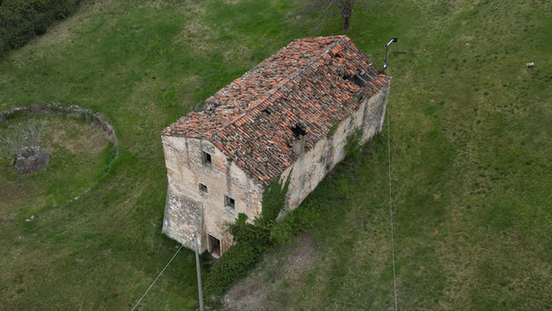
We have been commissioned by one of our clients to carry out some surveys at a private property in the municipality of Illasi (VR). This intervention, although modest, proves to be a good synthesis of our work organization.
PROJECTING AN INTERVENTION
The preliminary phase involves identifying the object of the survey and designing the intervention. The first step is determining the equipment to be used in the intervention, in this specific case, the decision was made to use a DJI MINI 3 Pro drone.
This aircraft, characterized by its particular maneuverability and compact size, was preferred over models with more powerful but bulkier cameras, as the survey also involved some surfaces beneath a wooded area within the same intervention.
According to the client's needs, surveys can be supported by different types of georeferencing and measurement, such as: positioning of geodetic stakes and their georeferencing via GPS, marking of targets and noteworthy points using a total station, and possible identification of known topographic points for reference. In this specific case, given the client's choice to work in a local reference system, it was decided to place a series of photographic targets and manually survey their relative positions.
Given the decision to use a drone, we consulted ENAC maps on the D-Flight website and confirmed the possibility, within the intervention area, of using the aircraft in Open mode, meaning without the need to request airspace reservation.
With the survey mode and necessary equipment determined, we agreed with the client to establish the quotation value and the intervention day, based on the most suitable weather windows.
THE SURVEY
Following a ground inspection to identify any obstacles to the shooting operation (such as suspended cables, difficulties accessing optimal shooting areas, etc.), a flight plan was established. Before the actual shooting, a series of photographic targets were placed, and their measurements were taken to ensure the correct scaling of the models once completed.
After completing the preliminary operations, we conducted the drone flight, lasting approximately 35 minutes, and completed the photographic mapping of the building, through a sequence of 138 photographs with the 48MP camera mounted on the drone, carefully covering every angle.
DATA PROCESSING
Back in the studio, we downloaded the photos taken onto our computers. Among the various photogrammetric reconstruction software, we opted to use Agisoft Metashape Pro. The photos were uploaded, and alignment, scaling using the targets placed during the survey, dense cloud creation, and finally a high-quality 3D mesh were executed.
From the generated model, high-resolution orthophotos of the four facades and the roof were extracted, which you can observe here alongside.
From these, an accurate vector DWG file suitable for the restoration interventions requested by the client was produced.


